Knowledge Networking Portal for Sustainable & Responsible Tourism


 Trekking from Machhakhola to Jagat

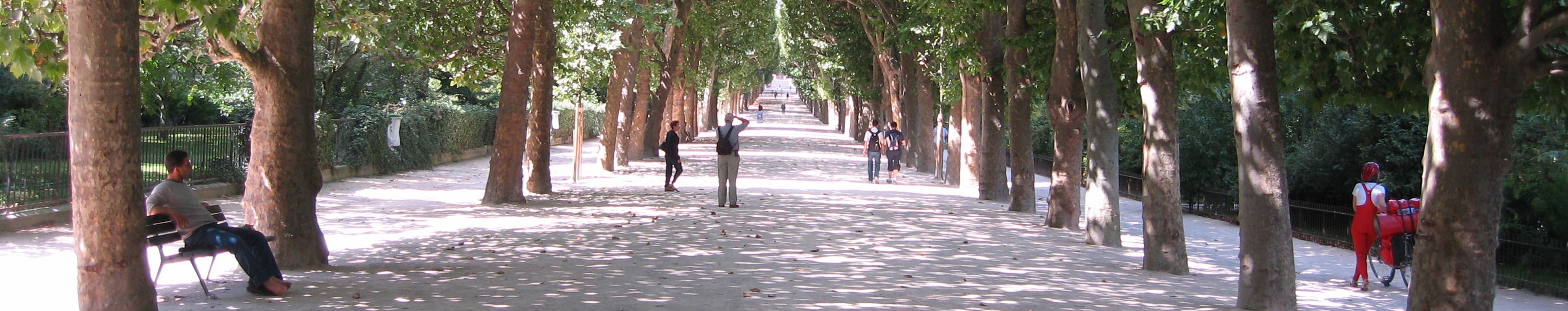
Introduction: Starting Your Manaslu Journey — Machhakhola to Jagat Overview
Start your Manaslu Circuit from Machhakhola to Jagat, covering the entire path with information about the route, elevations, villages, permits, costs, and Himalayan landscape.- Machhakhola starting point (900 m)
- Jagat checkpoint village (1,340 m)
- Trekking route to the Budhi Gandaki River
- Ganesh Himal (7,422 m) views
- Trekking permits and fee for Manaslu
 s
s After that, it follows the route through the Budhi Gandaki River, descending through Khorlabesi (970 meters) and Tatopani (990 meters), which includes natural hot water springs. In this part, there are examples of Gurung village life, stone houses, and agricultural slopes. The Manaslu Circuit Trek through the river provides adventure and exposure to local culture, walking along the river route.
Moving ahead, the trail begins to climb to Doban (1,070 m) and Yaruphant (1,110 m), where suspension bridges stretch your balance as well as your determination. These parts of the trail increase the overall trekking endurance while experiencing the diversity found within the Himalayas. The day at Machhakhola to Jagat qualifies as the adventure-wilderness discovery day.
From open ridges, first sightings can be had of Ganesh Himal (7,422 m) and Shringi Himal (7,161 m). This establishes the Alpine atmosphere that will be experienced during the trip. It’s exactly what the trekker needs in order to be motivated for what lies ahead in the Manaslu Circuit. At last, the Jagat (1,340 m) is the point where trekkers officially begin to enter the Manaslu Conservation Area. It is where trekkers register their permits to enter the controlled trekking region, thereby initiating the restricted area trekking in Manaslu.
Here, important permits that must be obtained are Manaslu Restricted Area Permit, Manaslu Conservation Area Permit, and Annapurna Conservation Area Permit. The cost of the permit depends on the duration and changes between 100 and 140 US dollars. This amount supports sustainable tourism.
Likewise, the first day of the trekking experience focuses on acclimatization for the body to the higher elevations, the increased walking distance each day, and the peculiarities of logistics. The route from Machhakhola to Jagat concentrates on acclimatization and good physical fitness to enable smooth hiking in the higher stages of the Manaslu circuit.
In practice, the presence of experienced guides can significantly improve the trek’s safety, route orientation, as well as cultural understanding. A guided trip is really helpful in dealing with the permits, accommodations, as well as emergency responses. Such an adventure can be suitable for both inexperienced as well as experienced trekkers in the Himalayas.
0.81855800%201738673284.webp)
In fact, the Machhakhola to Jagat portion of the trek introduces you to the best of the Manaslu Circuit experience. River valleys, villages, and breathtaking views of the Himalayas in the background – all of these without putting in much effort, which contributes to the Manaslu Circuit Trek being the best off-the-beaten-path destination in Nepal.
Trail Snapshot: Distance, Duration & Elevation Gain Explained
Find the distance, walk time, altitude gain, trek difficulty, and environment for the Machkakhola to Jagat part of the Manasla Circuit.
Trail Data Overview:
- Element: Distance – ~22 km
- Duration — 6-8 hours
- Initial Elevation: Machhakhola (900 m)
- Final Elevation – Jagat (1,340 m)
- Total Elevation Gain - Approximately 800m
- Difficulty – Moderate
- Key Mountains – Ganesh Himal (7,422 m), Shringi Himal (7,161 m)
Second, the cumulative height gain is approximately 800 meters from Machhakhola at 900 meters to Jagat at 1,340 meters. This cumulative gain allows for proper acclimatization as you ascend by engaging a series of gentle slopes that ensure a relative ease of access.
Here, the route mix includes narrow trekking trails, stone staircases, as well as suspension bridges. The river crossing in Budhi Gandaki River (approximately 400 meters) serves as an adventure piece in the trekking route, contributing to the robust nature of Manaslu Circuit trekking.

Likewise, the weather is one factor which affects the duration of the trek, particularly during the monsoon season and winter. The dry seasons ensure a stable trail with good mountain vistas. Season planning increases effectiveness and provides a better Manaslu experience. En route, there are villages such as Khorlabesi (970 m), Tatopani (990 m), Doban (1,070 m), or Yaruphant (1,110 m) that provide rest stops with tea houses, food, and water sources along the way. These stops are very useful in pacing the trek performance.
Further, the trail remains moderate, but the hike still requires careful footwork. In the areas where there are chances of landslides, be very careful and seek the help of guides. This phase of the hike further instills the need to be careful while Manaslu Trekking.
In fact, this lengthy day proceeds more smoothly with lighter packs. There’s no doubt that good trekking equipment makes a difference in reducing exhaustion and keeping Manaslu treks sustainable.
More importantly, knowledge about distance, time, and elevation can enable you to make realistic plans for your day. This approach will minimize the risk of injury, as it will further strengthen your design for the Manaslu Circuit trek route.

In conclusion, the section between Machhakhola and Jagat is physically challenging yet manageable—a mix of climbing, scenic, and interaction possibilities with the local population. The section serves as a warm-up for the more difficult sections that follow in the Manaslu Circuit.
From Riverside Hamlet to Gateway Village — Machhakhola's Trailhead Experience
Machhakhola (900m) is the entry point village for the Manaslu Circuit Trek and a combination of river sensations and Himalayan trail buzz to look forward to.
Trailhead Highlights:
- Village: Machhakhola (900 m
- River: Budhi Gandaki River (400 m)
- Peaks: Ganesh Himal (7,422 m), Shringi Himal (7,161
- Services: TIMS registration, guide coordination, teahouses
- Culture: The village life in the Gurung/Magar area, prayer flags, agricultural terraces
Likewise, the trek starting atmosphere at Machhakhola (900 meters) offers a perfect blend of typical Nepali village life and trekker facilities. The sight of stone houses, prayer flags, and fields adds a picturesque element to the place. Interactions of the local Gurung and Magar communities along with trekkers create an opportunity to gain knowledge of these communities and their way of life, as well as learning about arts and hospitality.
Furthermore, Machhakhola (900 m) also provides necessary Trekking related services like TIMS card, permit status, and arrangement for a SHERPA guide. Machhakhola can be reached by jeep or bus from Kathmandu. The alternative accommodation services for meals and a place to sleep, as well as Trekking advice for equipping the necessary gear for the first day of the hike, Budhi Gandaki River (400 m), have been considered. The necessary information for the trail, the rivers, and forest routes has also been given for the Manaslu Circuit Trek.
Furthermore, the village’s strategic location promotes acclimatization and physical preparation. Trekkers get to acclimate to their backpacking gear, porter arrangement, and trekking routes to Jagat (1,410 m). Early immersion in the local food, prayer rituals, and village celebrations increase trekkers' immersion in the culture of the place. The location of Machhakhola lends itself to being prepared for adventure while being immersed in nature’s beauty and culture. Finally, the riverside trails of Machhakhola (900m) surround the trek with a peek into Ganesh Himal (7,422m) and Shringi Himal (7,161m). These mountains top off the valley with instant camera shots. The trek takes a pause observing the reflection of the forested slopes into the cliff roads of the Budhi Gandaki River (400m). The trek secures trekker interest, energy, enthusiasm, excitement, and delight of adventure trekking by engaging them with captivating nature sights.
Moreo0ver, the Machhakhola trekking trail represents a point of beginning, which is crucial for the significance of sustainable tourism to begin in earnest. The locals emphasize the fact that it is all about some basic decisions: correct management of waste, proper trekking, and respect for the local culture. This approach ensures the preservation of the environment not only in the gorge of the Budhi Gandaki River (400 m), but also in the Manaslu Conservation Area.
In this regard, Machhakhola (900 m) combines natural attraction, immersion into culture, and acclimatization for trekking into an integrated process and experience. In this manner, you can appreciate and feel the attraction to village life while at the same time recognize your acclimatization with regard to Himalayan adventures through this gateway village.
Initial explorations along the Budhi Gandaki River
The initial stage is along the Budhi Gandaki River from Machhakhola to Jagat, which is an ascent of 400m.- Starting: Machhakhola-900 m
- Villages en route: Khorla Besi (970 m), Dovan (1,070 m)
- River: Budhi Gandaki River (400 m)
- Peaks visible: Ganesh Himal 7,422 m, Shringi Himal 7,161 m
- Features of trail: Suspension bridges, stone staircases, forested paths
Here, the initial trail for the Budhi Gandaki River begins just past Machhakhola, gradually ascending into one of the most popular trekking regions within the Himalayan ranges. The route involves lush mountainous regions, river banks, and suspension bridges, all contributing to an active route for photographs. The route will also involve stone steps, difficult mountain routes, and river routes for trekkers to appreciate local flora and fauna on their initial trek.
Further, the trail connecting Machhakhola to the surrounding countryside, such as Khorla Besi and Dovan, is very pleasant. Early stops afford the hiker the opportunity to have lunch or refreshes in the form of teas at the teahouses. Hiking through the river valleys helps the body to acclimate to the temperatures by drinking plenty of water. Interactions with the local population not only impart cultural knowledge but also prepare the hiker physically.
Likewise, the riverside walk offers a window into the varied Himalodian ecological systems of the Nepalese environment. The presence of rhododendron and pine as well as the terraces provide a picturesque background for the walk. The bird and small animal life provide additional points of observation, combining the interests of nature and the adventure of trekking. Moreover, suspension bridges crossing the Budhi Gandaki River, respectively, at Khorla Besi and Dovan, reflect the elements of adventure and engineering. The trekkers improve their balancing, concentration, and awareness of safety while crossing such suspension bridges. The bridges provide excellent photo opportunities, which boost confidence of trekkers prior to more challenging treks like Manaslu Circuit Trek. Trail conditions tend to be moderate but as true to the weather, it can change. Trails are made slick by rain, fog might obscure river views, but the guides give valuable advice on how to take steps properly or the use of trek poles. Being trail-conscious ensures conservation of energy and a rewarding first-day experience.
In fact, it is about 400 meters where the path bifurcates towards the Budhi Gandaki River. This gives an instant, visual shock of the Himalayan scenery. You will see Ganesh Himal towering at 7,422 meters, Shringi Himal at 7,161 meters, and all the ridgelines around that get your sense of adventure going. These early, sweeping views make a thrill for the trek, deepen cultural immersion, and create fantastic photo opportunities.
Thus, the first stretch along Budhi Gandaki, being approximately 400 meters above sea level, weaves activity and culture together with just visual richness. Trekkers build confidence, acclimate a little more smoothly, and get a real feel for the Manaslu Circuit. It sets the pace of the trek by taking those steps to gear you up in case you actually attempt Himalayan exploration.
Elevation Profile — The Ascent From 900m To 1,410m
Study the Machhakhola to Jagat ascent profile, gain, acclimatization indications, change of landscape, and trekking advice for the Manaslu Circuit trek.Elevation Breakdown Table:
| Location | altitude |
| Machhakhola | 900 m |
| Khorlabesi | 970 m |
| Tatopani | 990 m |
| Doban | 1,070 m |
| Yaruphant | 1,110 m |
| Jagat | 1,410 m |
Initially, the trail extends along gentle curves of the riverside area towards Machhakhola. The initial phases of the trek give trekkers a gentle warm-up session, help stretch the muscles, and allow trekkers to set a rhythmical breathing pattern. It is a point where concepts of acclimatization, altitude awareness, and trekking concepts of endurance begin to develop.
Further, you continue rising, and the trail gradually climbs to Khorlabesi at 970 meters altitude, offering just enough height gain. The gentle grade is an excellent way to avoid any shock from altitude sickness and furthermore is an example of tried-and-true Himalayan route-building.
Moreover, the route continues with a moderate trek to Tatopani at 990 meters, which is a place recognized for its natural hot springs. This higher point provides an opportunity to regain health prior to proceeding, which will help in balancing the activity with recovery in the elevation profile towards Machhakhola to Jagat. After this, the trail moves to Doban at 1,070 meters and Yaruphant at 1,110 meters. This part of the climbing process makes the trail slightly steeper. This part helps to improve the endurance of your legs as you trek to the Manaslu trails.
Likewise, elevation climbs get even steeper once you pass Yaruphant at 1,110 meters, all the more when facing spots where the route is threatened by landslides. One has to be thoughtful with breathing and pacing. Handling altitude properly cuts fatigue, boosting trekking safety.
Hence, the final push to Jagat at 1,410 meters feels strong but doable. That ascent builds confidence for higher elevations on the Manaslu Circuit ahead. The profile here serves as a training ground for the days to come.
In return, this climb gets trekkers prepared for villages above 2,000 meters later in the itinerary. The early exposure to changing elevation improves long-term acclimatization success. This plan aligns with professional standards of Himalayan trekking.
Meanwhile, the surrounding peaks-Shringi Himal at 7,161 meters-are seen throughout the ascent. The mountain scenery motivates the trekkers and provides altitude reference points. These views give the peak strength to mental stamina.
Similarly, when compared to the Budhi Gandaki River standing at 400 meters, it means that this represents a serious drop away from the trail and really underlines vertical gain. The contrast makes altitude gain intuitive and develops a good trekking habit.
This also is partly emphasized by guides: hydrating well and pacing steadily during this climb. These practices minimize the altitude-related discomfort and support safe trekking on the Manaslu Circuit.
Consequently, most trekkers can still manage around 510 meters of total elevation gain. The balance is suitable for both beginners and seasoned hikers. It helps to set up good habits of sustainable trekking on the ascent from Machhakhola to Jagat itself.
The elevation gain from 900 meters to 1,410 meters offers a responsible introduction to Himalayan altitude trekking. It merges gradual ascent, scenic motivation, and physical conditioning, anchoring the long-term success of the Manaslu Circuit Trek.
Trail Conditions: Forest Trails, Suspension Bridges, and Rocky Slopes
Learn about the trail conditions on the Machhakhola to Jagat trek via forest trails, suspension bridges, and rocks for the Manaslu Circuit Trek.- Forest trails along the Budhi Gandaki River (approx. 400 m)
- Several suspension bridge crossings
- Rocky, landslide sections near Doban (approximately 1,070 m)
- Narrow trails along the cliff face below Jagat (about 1,410 m)
From Machhakhola (900m) to Jagat (1,410m), the trek remains wonderfully varied and interesting. Trekkers walk on forest trails, climb over rocky sections, as well as cross rivers. A blend of this is the essence and excitement of trekking the Manaslu Circuit.
Here, the trek begins along the forest trails, hugging the Budhi Gandaki River (about 400 m). The dense forests ensure ample shade and humidity, typical trekking sensations in the Himalayas.
Likewise, suspension bridges feature quite frequently. They stretch over the sides of steep valleys. To get over these, a certain amount of balance, care, and courage are required. They add to the adventurous feeling in the trail to the top of the Manaslu.
In the area around Doban (1,070m), rock sections dominate, particularly in areas susceptible to landslides. Careful foot placement is again essential, teaching trekking skills along the way. There are also stone stairways that have been chiseled into mountain faces, requiring careful, deliberate walking. Such stairways are hard on knees and ankles, and hiking boots are an absolute necessity for trekking on these stone surfaces in the Manaslu Circuit.
The train width varies considerably, especially near the edge of the cliffs. Certain areas require gouping to stay in single file, with guides positioning the group so all remain safe.
[trip:
More importantly, the weather is a significant factor making trail conditions what they are here. The problem comes if it rains, as the stone roads become slippery, as a glob of mud can clog the path completely. It is important to be aware of the weather conditions ahead of time.
This is where trekking poles are important because they assist with stability when hiking on uneven surfaces, in addition to making it easy when climbing up or descending. Trekking poles assist in the smooth movement of a trekker during the Manaslu trek.
Likewise, a little past the point at which the trail leaves the pine forest, at a spot called Khorlabesi with elevations around 970 meters, the paths in the woods provide softer soil and cooler air, facilitating rapid recovery between the rocky sections.
Areas of exposed rock along the route around Yaruphant, around 1,110 meters, will put your focus and endurance to the test. This kind of terrain allows you to prepare for what's to come.
In fact, local maintenance allows the major trails to remain usable, even when affected by monsoon damage, as community engagement sustains the route in the Manaslu mountain range. Financial help through responsible tourism supports these efforts. The trail, on the whole, is always moderately difficult and interesting. There is a good physical workout without any rock climbing, so this trek attracts a variety of trekking enthusiasts.
In total, the combination of forest trails, suspension bridges, and rocky parts makes up a typical Himalayan trekking adventure. This is what makes up the day’s trek from Machhakhola to Jagat, which instills confidence for even more challenging treks, such as the Manaslu Circuit.
Tatopani Hot Springs — A Refreshing Mid-Day Relief on the Manaslu Circuit
Unwind at Tatopani Hot Springs (990 m) while on your Manaslu Circuit Trek and immerse yourselves in natural baths and Himalayan culture.Tatopani Hot Springs Highlights:
- Elevation: 990 m
- Natural geothermal hot springs
- Scenic views of Ganesh Himal (7,422 m)
- Tea houses and local food available
- Ideal mid-day rest for trekkers
 In fact, Tatopani (990m) is a perfect resting point for lunch during the trekking journey of Machhakhola to Jagat. The natural water springs of Tatopani serve as a warm and rejuvenating conclusion to trekking for hours and act as a means of replenishing the body for trekking in the Manaslu region while basking in the beauty of the Himalayas. The springs incorporate wellness, trekking adventure, and immersion in Manaslu culture.
Likewise, the hot springs are driven by geothermal forces along the fault lines in the area. Soaking in the springs not only relieves one of fatigue along the trek but also increases blood circulation. Taking a break in the hot springs allows one to see Ganesh Himal (7,422m) if the mountain happens to be in the area because the motivation for the trek and the healing power of Mother Nature are well linked.
Further, Tatopani is another village that contributes significantly to the stopover at the tea houses. An overnight stay costs around USD 8-15 per person depending on the season. Of course, the blend offered by this stopover at Tatopani enhances the Manaslu circuit experience since the hikers get to interact with porters, guides, as well as other hikers.
In fact, cultural exchanges make the Tatopani stop-over even more interesting. Cultural experiences include stories of local customs and agricultural life in rural regions. Trekkers become exposed to rural life in the Himalaya through the Manaslu trek. The ever-darkening trails and river views add to the sense of place. The trek from Doban to Tatopani (1,070 m to 990 m) includes river crossings and climbs, while the Budhi Gandaki River (around 400 m) contributes to the nature ambiance and adventurous spirit. For photography enthusiasts, capturing images of the Himalayan landscape is no less than an endeavor.
Importantly, the guides on the trail recommend a quick 30-45-minute stop to avoid delays piling up. Spending too much time in the hot water may drain your energy or leave you running on empty. Smart planning helps pace your energy for the leg ahead up to Jagat at 1,410 meters. This careful timing reinforces safe practices on the Manaslu Circuit.
In fact, Tatopani naturally becomes both a physical recharge and a mental reset. Trekkers rebuild strength for the steep climbs to come and soak in a touch of local Himalayan life. That midday pause thoughtfully unites wellness, scenery, and culture.
A stop at Tatopani Hot Springs-990m remains one of the best moments on the Machhakhola-to-Jagat day, offering recovery time, uplifted views, and cultural insight. These stops are very likely to improve overall trekking performance and satisfaction in the Manaslu Circuit Trek.
Village Encounters – Khorla Besi & Dovan Cultural Attractions
Explore Khorla Besi (970 m) and Dovan (1,070 m) trek on Manaslu Circuit Trek, immersing yourself in the culture of Gurung people.Village Highlights:
- Height of Khorla Besi: 970 m
- Dovan elevation: 1,070 m
- Traditional Gurung village and stone house
- Teahouses and local markets
- Exposure to the Culture of the Himalayas
Here, Khorla Besi (970 M) provides an insight into rural Himalayan culture on Manaslu Trek. Cultural diversity is brought to the fore through the unique houses in the village, the agricultural patterns in the form of terraced fields, and the practices of the Gurung people. Socializing with the inhabitants will give an insight into daily rural practices, agriculture, and the hospitality.
Moreover, Dovan (1,070 m) integrates beautiful trails along the forested tracks with cultural exposure. Trekkers get to walk along the village lanes, observe farm activities, and talk to the cordial residents. The significance of this place is to increase cultural bonding, add to the pleasure of trekking in the Himalayas, and increase awareness about nature. The village’s historical background is also discussed.
Both villages also have tea houses and marketplaces. The meals and rest breaks normally cost between 5-12USD and are well priced to help the economies of these small villages while remaining within budget for travelers. Community-based tourism supports employment and the conservation of traditions.
Likewise, the festivals and traditions, as well as local arts and native clothes, often interest trekkers. Engagement with the practical living within the villages provides immersion into the culture. This provides insight into the way of living in the Himalaya. Situated in the lap of the Budhi Gandaki River (at 400 m), the villages offer a serene trail break. The dense forest trail and sound of the river make it very invigorating and motivating to move further towards Tatopani (at 990 m) and Jagat (1,410 m).
Additionally, guides emphasize respect for local traditions as part of the adventure process. Photography permits, behavior, and minimizing disruptions contribute to greater trekker and local relationships. The Manasla Circuit remains strong and green if trekkers behave in a positive manner.
Thus, visits to villages become much more than simply a relief from trekking on the trails. Rather, they offer chances to learn and to appreciate the subtleties of culture as well as interact with the locals. This rounded experience boosts the entire process of trekking Manaslu. At the center of all these, however, lie Khorla Besi (970m) and Dovan (1,070m), which symbolize the essence of a typical Himalayan village as seen along the Manaslu Circuit Trek. This blend of cultural interaction, scenic beauty, and hospitality adds great depth to the entire trek.
Sunrise Views & Riverside Scenic Land Along the Budhi Gandaki Gorge
Enjoy the spectacular views of the sunrise and the river side scenery through the Budhi Gandaki Gorge (400 m) on the Manaslu Circuit Trek.Highlights:
- Budhi Gandaki River elevation: 400 m.
- Villages along the River: Khorla Besi (970 m), Dovan (1,070 m).
- Mountain views: Ganesh Himal (7,422m), Shringi Himal (7,161m).
- Photography & Sunrise Points.
- Rivers, Cliffs, & Wooded Landscapes.
First, a trek from Machhakhola to Jagat, with its 400m long Budhi Gandaki Gorge, commences with a sunrise viewpoint that establishes a lasting background mood for this trek in Nepal. The early morning moments of sunlight on the summits of Ganesh Himal, 7,422m, and Shringi Himal, 7,161m, transform these mountains into subjects fit for pictures taken during a Himalayan trek.
Next, the landscape along the Budhi Gandaki River comes with cliff-sided scenery, forested areas, and agricultural slopes lining the river. The path winds its way through a settlement such as Khorla Besi (970m) and Dovan (1,070m), offering peeks into the settlement dwellings and agricultural areas. River rapids, suspension bridges, and valley mists provide a good mix between adventure, mountain majesty, and immersion into culture.
As you walk along the gorge, there are viewpoints which encourage you to pause and appreciate the river’s turns, waterfalls, and cliffs. These are ideal spots for nature observation like bird watching and spotting wildlife, with the background sounds of the river, the soft Himalayan climate, and panoramic sights.
With each step ahead, the trail rises towards Tatopani (990m) and then Jagat (1,410m), sharing glimpses of unfolding river perspectives and canyon formations. The trail tosses between steep sections and forested trails, finally unwinding into lines along ridges, making it a constantly altering treat for the eyes. Such elements make the Machhakhola to Jagat trek highly engaging and enthralling. En route, the aquatic environments facilitate diverse Himalayan vegetation, with rhododendron, oak, and pine trees lining the slopes. The valleys allow the habitation of bird species such as the Himalayan monal and other forest birds. The observation of wildlife during the absorption of sunrise views adds to the adventure of trekking.
Further, the treks lead one to follow a proper schedule, with waking up early to witness a Himalayan sunrise safely. Starting early not only provides one with a perfect sight of the mountains, with clouds below and snowy mountains at a distance, but also helps avoid heat on some parts of trekking trails.
Here, this combination of river scenery and early morning light presses trekkers towards the 22 km route for the rest of the day. What you get to see makes the attempt worthwhile as you experience the pull of a led Manaslu Circuit Trek. Scenery not only makes the activity more attractive but also encourages continued involvement.
But what makes this stage of the trek are the sunrise views over the Budhi Gandaki Gorge to the 400-meter drop, along with the riverside views from Machhakhola to Jagat. It is where nature’s beauty, trekking adventure, and cultural experience all converge to reaffirm why the Manaslu Circuit is known for its breathtaking views of the Himalayas.
Himalayan Flora & Fauna – Forests, Bird and Rhododendron Trails
Learn about the flora and fauna on the Machhakhola to Jagat trekking route in the Himalayas, such as the forests, rhododendrons, and bird species on the Manaslu Trek.Flora & Fauna Highlights:
| Feature | Details | Elevation |
| Forests | Oak, pine, rhododendron | Doban 1,070 m, Tatopani 990 m |
| Birdlife | Himalayan monal, sunbirds | Along Budhi Gandaki River 400 m |
| Wildlife | Musk deer, langurs | Forested slopes near Dovan 1,070 m |
| Flora Trails | Spring rhododendron bloom | Dovan 1,070 m, Tatopani 990 m |
Actually, the route between Machhakhola and Jagat traverses through a variety of forests in the Himalayas, including oak, pine, and rhododendron (Doban 1,070 m; Tatopani 990 m). This part of the route provides shade, clean air, and a scenic route that offers trekkers and nature enthusiasts the opportunity to learn about and discover the variety of plant life.
Here, spring is when the Rhododendron trails come alive, and these trails transform the land-scape into a living canvas. This could be the raison d'être for trekking photography or the added element that instills a relationship with the Environment in the treks in the Himalayas.
Likewise, bird life also accompanies treks, with some species of Himalayan monal and sun birds among others found only in this region. Early morning treks also reveal bird sighted as the sun rises to peak behind Ganesh Himal (7,422m). Bird watching as a form of wildlife observation incorporates adventure treks and a certain reverence for the surroundings of the Budhi Gandaki River (400m).
Occasionally, you get to see animal tracks and pictures of the fauna found in the Himalayas, such as musk deer and langurs. Guides provide information on species, their natural habitats, and patterns according to the season, thereby making eco-tourism more interesting and also emphasizing the importance of responsible trekkers within the Himalayas. The trekking trail varies from dense forests to mountain tops with open slopes that can sustain different varieties of plants. The climbing trails around the area of Dovan with an elevation of 1,070 meters and Tatopani with 990 meters show rice fields and local vegetation. This shows the compatibility of the natural environment and human activities within the foothills of the Himalayas.
In fact, the changes in the seasons affect the condition of the forests, and these, in turn, determine the safety of the trails as well as the possibilities of what one can observe on the flora. In monsoon trails, one requires care in path-following skills, but in spring, one gets a display of rhododendron blooms and better bird-watching possibilities.
In conclusion, a trekker can enhance his/her trek experience with a visit to Himalayan flora and fauna. There is a combination of exercise, environmental, and cultural knowledge acquisition during trekking, which makes sustainable trekking possible on a Manaslu Circuit trek.
Observing forests, trails of Rhododendron trees, and birds of the Himalayan range from Machhakhola until Jagat increases the value of this trek. All these encounters enhance the elements of Eco-Tourism, Photography, and trekking Adventure in the Himalayan ranges simultaneously while preparing trekkers for the higher Himalaya ranges.
Steep Staircases & Suspension Bridges — What to Expect on the Path
See what awaits you on your journey from Machhakhola to Jagat – steep stairways, suspension bridges, and Himalayan adventures through Manaslu Circuit trekking.Trail Highlights :
- Stone staircases: Doban (1,070 meters), Yaruphant (
- Suspension bridge over the Budhi Gandaki River (approx 400m)
- Steep areas with narrow cliffs that sometimes have handrails.
- Visible peaks: Ganesh Himal (7,422m), Shringi Himal (7,161m
- Safety tips: trekking poles, paced treks, attention to season
First, you will encounter a lot of stairways on the way from Machhakhola to Jagat, especially when reaching Doban (1,070m) and Yaruphant (1,110m). The stairways made of stones require a lot of effort in footing, balance, and pace. The stairways are a test of the strength in your legs before embarking on a trekking adventure in higher altitudes. The stairways, along with bridges and trails, become an adventure in themselves because they balance adventure with safety.
Second, suspension bridges are used to cross the gorge of the Budhi Gandaki River and its tributaries, which are 400m deep. The bridges are of different lengths and levels of stability, requiring trekker attention, equanimity, and a touch of bravery. The exercise enhances trekker confidence and alertness for safety.
Then, it comes a pattern of forest trails and exposed ridges. Hikers trek through narrow trails lined with a precipice, which is made safe through handrails and ropes in certain areas. Staircases, bridges, and narrow ridges characterize traditional Himalayan treks. It is important to be conscious and careful with safety while at the same time embracing the adventure.
Moreover, during the rainy/monsoon season, the stairs can be slippery and the bridges more challenging. The use of trekking poles, appropriate footwear, and maintaining an effective trekking rhythm are necessary. Careful planning prevents injury and increases the quality of this Manaslu Circuit trek route. Finally, the trail treats you to breathtaking mountain scenery, including Ganesh Himal (7,422m) and Shringi Himal (7,161m). There will be resting points at the suspension bridges and ridges to take in the sights. The resting points serve as encouragement to push through the challenging sections.
Importantly, trekking guides indicate the importance of taking a short break after crossing every large hanging bridge and climbing stairs. Trekking through the route taking regular short breaks enables adventurers to acclimate by conserving energy and avoiding fatigue as they ascend to higher elevations. Taking regular short breaks enables the trek to proceed with a smooth pace.
By understanding what to expect from trekking— steep steps, suspension bridges, and small tracks—it becomes possible to mentally and physically prepare. Awareness of what the trail entails promotes confidence and safety and will allow overall satisfaction of an adventure trekking day.
On the whole, the Machhakhola to Jagat trek combines physical effort with one of the most beautiful Himalayan landscapes. The day's nature, as far as effort is concerned, is defined by stairs and suspension bridges, improving fitness levels. With sufficient preparation, the Manaslu Circuit Trek is an unforgettable endeavor.
Food & Fuel — Dal Bhat, Noodles, Tea Stops Along the Route
Investigate food alternatives on the Machhakhola to Jagat Manaslu Trek: dal bhat, noodles, tea house options, and advice on trekking energy.
Food and Fuel Highlights:
- Staple meal: Dal Bhat (energy and protein)
- Alternative meals: Noodles, soups, fried snacks
- Tea stops for hydration and warmth
- Villages: Khorla Besi (970 m), Dovan (1,070 m), Tatopani (990 m), Jagat (1,410 m)
- Average meal cost: USD 5–12 per stop
Here, teahouse Trekkers believe that teahouse rest points, located in villages that include Khorla Besi (970m), Dovan (1,070m), Tatopani (990m), and Jagat (1,410m), where they get an opportunity to dine and rest, along with a variety of meals that include dal bhat, noodles, and local snacks, enhance this trek experience.

In fact, the "dal bhat" remains the core of trekking food, consisting of a plate of rice and a variety of lentils and vegetables, with an option of meat added on top. The combination of all this provides a perfect balance of energy and nutrients for trekking, which has a longer 6-8 hours duration every day.
They also offer beverages like tea, coffee, and herbal teas. Drinks help a lot in keeping one hydrated, especially in the mornings when it is chilly. They also act as an Add on activity for the travelers to enjoy in the Himalaya.
Moreover, at mid-route villages, ‘teahouse meals' such as noodles, soups, and occasional ‘fried treats' are served. These meals act as sources of ‘quick' energy for the steep routes and bridge crossings. The teahouses in these villages ensure that meals are reasonably priced, with meals ranging from USD 5 to 12, making Manaslu trekking budget-friendly. In the area around the Budhi Gandaki River trails, hydrating (reaching 400m) and the forest trails, boiled drinking water, or electrolyte fluids consumed can help avoid fatigue and altitude sickness. This includes regular breaks every 60- to 90-minute hike made by the trekking guide.
Important point: eating healthy meals at the right time along with short pauses helps increase the strength of trekkers on the hike. Trekkers need to properly plan their meals without compromising on the strenuous activity of walking uphill on stairs and walking on suspension bridges.
Moreover, food availability on Manaslu Trek, quality, and diversity impact overall trek satisfaction. Teahouse facilities serve as a source of sustenance, heat, and engagement with different cultures. Villages like Khorla Besi, Dovan, Tatopani, and Jagat serve as vital halts on the trek of Manaslu Circuit Trail.
Eventually, Dal Bhat, noodles, and tea stops help set the tempo for a successful day while trekking. The food provides much-needed stimulation in terms of food, culture, and resting opportunities, which can improve the safety and enjoyment of an adventure in the Himalayas when properly considered.
Accommodation in Teahouses - Rest and Local Hospitality in Jagat
Discover teahouse nights in Jagat (1,410 m) on the Manaslu Circuit Trek, a perfect place to have a comforting break.Teahouse Highlights:
- Location: Jagat (1,410 m)
- Room types: 2–4 shared beds, basic bedding
- Amenities: Hot showers, Wi-Fi, charging facilities
- Meal options: Dal Bhat, noodles, soups, tea
- Average cost: USD 8–15 per night
Jagat (1,410 M) is home to the more traditional tea houses, marking the first big night stop on the Manaslu Circuit Trek. Trekkers can expect to see the true hospitality of the people in the region, as well as quality sleep and meals.
Here, the room configuration in Jagat teahouses usually accommodates 2-4 persons and has joint bathroom facilities. Hygiene, the availability of bedding, and the availability of water can vary according to the season. Cost per night can go from USD 8-15. This is kept quite affordable for a Himalayan trek. Guides often book these rooms in advance to keep the Trek schedule unhampered.
Likewise, the teahouses also offer hot shower facilities, power points to charge your batteries, and internet accessibility. All these contribute to making the process of trekking more comfortable. The combination of warmth from the local people and the convenience of modern services offered by the Jagat teahouses greatly enhances the overall trekking experience of Manaslu Circuit.
Similarly, a typical food-for-sale at such tea houses would be Dal Bhat, noodles, soups, and tea. Hearty meals enable early departures for Tatopani (990 m) and other higher-altitude villages. The synergy associated with.rest, meal consumption, and interactions with the local environment enables greater efficiency and energy savings during the trekking adventure. It also helps to support the local economy when one stays at teahouses. The locals are employed as chefs, porters, and guides based on trekker traffic. Responsible trekking activities conducted at Jagat deal with community interaction and help to maintain culture while trekking at Manaslu Circuit Trail.
Likewise, teahouses on the Manaslu trek route are merely resting points. Teahouses also act as safe zones if the weather changes suddenly or when a person does not feel too well. Trek guides monitor the health of the trekkers closely, and teahouses can serve as safe stopping points. Having the benefit of local knowledge, updated mapping, and weather forecasts can significantly enhance trekker safety.
Thus, Jagat’s tea houses provide you with comfort and an insight into local culture and the necessary support from the Himalayas. They prepare you for the tough climbs and longer routes ahead. This quick and effective rest stop means you have higher chances of succeeding as you move from Machhakhola to Jagat. Spending the night in Jagat (1,410 m) gives the best of both worlds between living in the rugged lands of the Himalayas and long-distance trekking. These places are more than just resting areas; they are essentially hubs that add color to your whole Manaslu Circuit Trek experience.
Cultural Snapshots — Gurung, Magar & Bhotia Village Life on the Machhakhola to Jagat Trail
Explore the village life of Gurung, Magar, and Bhotia people starting from Machhakhola to Jagat, immersing into customs and traditions along with Himalayan manners.Village Culture Aspects:
- Villages: Khorla Besi (970 m), Dovan (1,070 m), Jagat (1,410 m)
- Tribes: Gurung, Magar, Bhotia
- Features: stone houses, terraced fields, traditional attire
- Events - Activities: Local festivals, handicrafts, farming practices
- Cultural focus: Sustainable lifestyles, Himalayan traditions, trekking engagement.
Meanwhile, the trail passes through several villages, including Khorla Besi at an elevation of 970 meters, Dovan at 1,070 meters, and Jagat at 1,410 meters, and these villages preserve the living pages of Gurung, Magar, and Bhotia culture. Stone houses, terraced fields, and traditional dress paint a graphic picture of life in the Himalayas. The trekkers get cultural insights, have a view of authentic lifestyles, and observe community-based tourism in operation.
Here, the Gurung and Magar retain their own specific traditions: the music, the dance, and the festival rites that light up the seasons. Prayer flags flutter, local instruments sound, and villagers come together for communal gatherings. It is in experiencing these traditions that allow for deeper cultural immersion, an appreciation of Himalayan heritage, and village connection.
Above them, the Bhotia tribespeople make sense of how life in the mountains stretches over the trans-Himalayan landscapes: stone walls, slate roofs, and farming of yaks define their homes, showing sustainable agriculture and alpine adaptation in action. Visiting settlements strengthens sensitivity to the need for cultural preservation and resilient livelihoods within mountains.
Likewise, villagers embrace trekkers with hospitality: sharing meals, offering handicrafts, and showing their farming techniques. Such interactions promote cultural understanding, responsible tourism, and education in trekking to the Manaslu Circuit.
Moreover, photography, storytelling, and evening chores unveil the rhythms of the Himalayan lifestyle. The trekkers glimpse rice planting, tending to animals, and the use of forest resources that underscore the sustainable practices, ecological mindfulness, and continuity of culture along the Machhakhola to Jagat route.
In fact, guiding at Manaslu is not just about showing the way upward but also about setting the pace for respectful village encounters, outlining appropriate etiquette, when and where photography should be done, and ways of treading lightly on the environment. Adherence to these guidelines helps retain trust with the locals and fosters deeper, stronger, mutually beneficial links between trekkers and the communities they pass through. Quite simply, responsible behavior underpins the long-term health of the Manaslu trek experience.
Because of this mindful approach, cultural moments on the trail are more than eye-catching snapshots; they're lessons in Himalayan life: how people adapt, how daily routines unfold, and how survival is practised with creativity and care. Physical effort is combined with environmental mindfulness and cultural insight to create a holistic journey that the trekkers are able to take home. Such exchanges lift overall satisfaction on the Manaslu Circuit.
Likewise, the trek along Khorla Besi (970 m), Dovan (1,070 m), and Jagat (1,410 m) gives one glimpses into the Gurung, Magar, and Bhotia villages personifying mountain life. Watching their traditions, listening to the architecture, and watching the rituals put depth into the trek and leave lasting cultural memories in the minds of its guests.
Safety Information - Landslide Areas, Trail Hazards, Weather Notes
Stay Safe while Trekking Machhakhola to Jagat with Tips related to Landslide Risk, Trails, and Weather on Manaslu Circuit.Safety Highlights:
- Landslide zones: Budhi Gandaki River (400 m)
- Trail hazards: Doban (1,070 m), Tatopani (990 m) staircases and bridges
- Weather awareness: fog, rain, snow, seasonal monitoring
- Equipment: trekking poles, waterproof gear, first aid kit
- Altitude precaution: Jagat (1,410 m)
Firstly, be mindful of the sections that are prone to landslides in the Budhi Gandaki corridor (approximately 400m). The danger can be severe due to heavy rain, instable slopes, as well as rocks that can move easily. According to guide instructions, the best approach would be to start early, wear robust footwear, as well as take trekking poles along.
Here, trail conditions to anticipate next involve challenging sections with steep-sided mountain roads and suspension bridge connections around Doban (1,070 m) and Tatopani (990 m). Such sections need special care and attention to avoid injuries and accidents. Taking necessary precautions with careful planning and close supervision by guides can prevent and minimize chances of accidents.
Actually, weather in the Manaslu circuit can be quite unpredictable. Fog, rain, and sometimes snow can reduce visibility on mountain ridges and while walking through forests. Trekkers are advised to keep an eye on the weather and be prepared accordingly. Staying aware of the weather can make a big difference in terms of comfort and efficiency.
Here, bridge crossings and slippery stone trails contribute to seasonal difficulty. During monsoon season, the river levels in the Budhi Gandaki River swell. Cross the river when the amount of water flowing is low. Preparations for the season can always help the trekker to cope with the circumstances when trekking. Awareness of altitude is critical as one ascends to Jagat (1,410m) or beyond. Though the ascents are not very steep at the beginning, acclimatization prevents one from getting any discomfort such as headaches, tiredness, or lightheadedness on the path from Machhakhola to Jagat.
In fact, it is always important to be prepared while trekking the Himalayas. And this includes having the essential first-aid box, trekking insurance, and communication devices. It is important not to expect mobile network coverage while trekking across the forest valleys and ridges. And the trekking guides will always have distinct emergency plans that will entail coordination with local health posts if need be.
Therefore, by combining knowledge of the trail with knowledge of the weather and the right gear, the risk factor significantly reduces for the Manaslu Circuit trek. Knowing the areas of potential landslides, suspension bridge idiosyncrasies, and river crossing areas goes a long way in ensuring that trekkers avoid accidents and feel more confident during their trekking adventure.
In the same way, when adventure trekking in the Himalayas, realizing the dangers on the Manaslu journey from Machhakhola to Jagat, paying attention to the climate, and carrying the right gears make the journey more enjoyable. By mixing the joy of adventure with care, the terrain can be more safely explored.
Photography Hotspots — Waterfalls, Prayer Flags & Mountain Vistas
Take incredible photographs on the Machhakhola to Jagat trekking route where falls, prayer flags, and the mighty Himalayan mountain range come together on the Manaslu Circuit trek.Photography Highlights
- Sunrise vistas: Ganesh Himal (7,422 m), Shringi Himal (7,161 m)
- Villages: Khorla Besi (970 m), Dovan (1,070 m) with prayer flags
- Waterfalls: riverside cascades along Budhi Gandaki River (400 m)
- Floral photography: rhododendron trails, forested slopes
- Panoramic viewpoints: Doban (1,070 m), Tatopani (990 m), Jagat (1,410 m)
The first light of the day along the Budhi Gandaki River (400m) provides a photographic backdrop. The early morning sun brushes against Ganesh Himal (7,422m) and Shringi Himal (7,161m) as trekers capture pictures featuring river reflections, forested mountains, and trekking trails along a majestic backdrop of sun-kissed morning mountains.
Then come the prayer flags seen in villages such as Khorla Besi (970 m) and Dovan (1,070 m). Prayer flags are cultural symbols that bring color and meaning to photographs. They feature believes and teachings in those believes that enrich the story in the Manasla Circuit Trail.
Here, the waterfalls along the trail provide plenty of scope for photography. The waterfalls come down along trees, farmland, and trekking trails, providing ample chances to take photos using slow shutter speeds as well as capturing nature photographs. The trail provides a fine mix of beauty and training opportunities along the Himalayas.
Further, the forested ranges and rhododendron corridors are perfect for taking pictures during the seasons. During spring, the ranges are dotted with colors, while during the monsoons, they are clothed in lush shades of green due to verdant vegetation. And then there are the extensive mountain vantage points in Doban (1,070 m), Tatopani (990 m), and finally in Jagat (1,410 m). From here, trekkers can take photographs of the Budhi Gandaki Gorge (400 m) and other mountains in panoramic pictures. Moreover, trekkers also include close-up photographs of the culture, which is an important aspect of their shoot.
Here, lighting conditions on the ridges as well as the valleys are very dynamic, hence the need to plan photo opportunities with the early morning and late afternoons at the top of the list. Using natural light in the photographs would be an effective means to improve the quality of the photographs since the Himalaya Mountains are endowed with varied scenery.
Adding photography to the trek is an excellent way to promote observing more intently and appreciate the trek more. Capturing images of waterfalls, prayer flags, and mountain vistas during the trek could add to the adventure and understanding quotient of doing the Manaslu Circuit Trek.
From Machhakhola to Jagat, there are more than enough opportunities for interesting photographs which mix natural scenery with cultural elements. The area around the river Budhi Gandaki has waterfalls and prayer flags which add to the trekking experience.
Entering the Manaslu Conservation Area — Permit Checks at Jagat
Learn about permit checks at Jagat (1,410 m) for entering the Manaslu Conservation Area, essential for safe and authorized Manaslu Circuit trekking.Permit Highlights:
- Day dawned with the cock's crow: - Location: Jagat (1,410 m)
- Documents needed: TIMS card, MCA permit, passport copies, trekking insurance
- Permit cost: USD 50 for 10 days, TIMS USD 20
- Purpose: legal trekking, trail safety and conservation funding
- Checkpoint function: Provides information about weather, trail, and village protocols.
Here, the entry into the Manaslu Conservation Area starts from Jagat (1,410m) and involves a permit check. It is here that one has to prove either that one has a TIMS (Trekkers’ Information Management System) card and an entry permit to the Manaslu Conservation Area. This process ensures that one is trekking legally along with a group of organized and safe trekkers.
Likewise, fees associated with MCA play their role in conservation. The cost for the Manaslu Circuit Trekking Permit is approximately USD 50 for foreigners valid for 10 days, with an addition for each day if your trek exceeds the days. The TIMS card normally costs around USD 20.
At Jagat, you will also gain practical information regarding trail, weather, and local custom details. Briefings regarding village mannerisms, high-altitude acclimatization, and season information will be given to trekkers by guides or local authorities. This kind of information will enable successful completion of the process.
Permit checks in the MCA function to manage the flow of trekkers within the protected area. They prevent overcrowding and deal with the effects on the environment within the Budhi Gandaki River valleys. This makes the regulated entry system essential for adventure trekking and the preservation of the environment. Finally, treks must submit copies of passports, trekking plans, and trekking insurance documents at Jagat (1,410 m). This ensures proper coordination of activities of trekkers during emergencies, health events, and rescue operations by concerned authorities during the Manaslu Circuit Trek.
More importantly, trekkers should carry a copy of their permit and TIMS card during the trek. Guides regularly check these documents at the latter checkpoints, such as Deng at 1,860 meters and Namrung at 2,630 meters. A proper following of MCA guidelines at the right time ensures easy access and makes trekking legally correct.
Thus, the Jagat checkpoint at 1,410 meters heralds an entrance into both adventure and responsible care for the environment. The completion of these formalities gives the trekkers a guarantee to move forward confidently within the Manaslu Conservation Area. With legal permits, environmental compliance, and support from a guide, the trek is more pleasant and secure.
Basically, the entry into the Manaslu Conservation Area from Jagat at 1,410 m links safety, legality, and cultural understanding. Permit checks assist in planning and trail conservation, ensuring responsible Himalayan exploration by providing authorization for trekkers and environmental awareness before they further continue along the circuit.
Best Time to Trek Machhakhola to Jagat: Seasonal Trail Insights
Uncover the best window to trek Machhakhola to Jagat (1,410m) based on seasonal signs, trail conditions, and general weather patterns of the Himalayas to attempt the Manaslu Circuit.Seasonal Insights:
| Season | Trail Condition | Highlights | Villages & Elevation | Notes |
| Spring (Mar–May) | Moderate, clear | Rhododendron blooms, wildlife | Khorla Besi (970 m), Dovan (1,070 m) | Optimal visibility, moderate crowds. |
| Autumn (Sep–Nov) | Stable, dry | Mountain vistas, crisp air | Jagat (1,410 m), Budhi Gandaki Gorge (400 m) | Peak visibility, cultural immersion. |
| Monsoon (Jun–Aug) | Slippery, landslides | Dense greenery | River valleys 400–1,400 m | Risky for trekking. |
| Winter (Dec–Feb) | Cold, icy | Snow-capped peaks | Tatopani (990 m), Doban (1,070 m) | Fewer trekkers, photography advantage. |
Meanwhile, Autumn (September to November) and spring (March to May) are considered to be the ideal period for trekking to Machhakhola and then to Jagat. The weather and rhododendron blooms at this time provide an ideal setting for trekking to occur. These periods improve trekking visibility and facilitate trekking planning.
Likewise, Monsoon season (June to August) is characterized by torrential rain and landslide conditions in the Budhi Gandaki valley (about 400 m), which can make trails treacherous, bridges unstable, and river water swell. Monsoon trekking can be dangerous unless properly equipped for it. It is important to synchronize treks with the seasons to ensure safety, enjoyment, and success of the Manaslu Circuit Trek.
Moreover, Winter (December to February) sees cold waves and snowfall in the higher reaches. Chilly mornings and icy trails in Tatopani (990 m) and Doban (1,070 m) require warm and insulating clothing. The trails are less crowded, but the views are crystal clear. The best time to photograph the mountains is in Winter when the sceneries are spectacular.
Specifically, Manaslu Circuit Trek in Spring welcomes rhododendron displays and Himalayan flora. The possibilities for wildlife observation and bird-watching increase. The climate is mild. The crowds are minimal. The environments come alive with the rugged settings and rich nature that spring makes so accessible. In addition, the autumn season provides comfortable days and cool nights with stable trekking conditions. The Ganesh Himal (7422m), Shringi Himal (7161m), along with surrounding ranges, become distinct, offering you the best Himalayan scenery. This season provides the best time for photographs, cultural experiences in places such as Khorla Besi (970m) and Dovan (1,070m), along with comfortable trekking conditions.
Here, the Machhakhola to Jagat trek is influenced by seasonal realities in every step. The conditions regarding accessibility and mobility change according to the seasons. Teahouses are operational in Jagat (1,410 m) and the Budhi Gandaki Gorge (400 m) during autumn and spring, making it an easier trek.
Thus, it is not only a matter of picking the right time to trek from Machhakhola to Jagat but also has serious implications when it comes to the conditions or climate, the safety features associated with the trail, the breathtaking sights to see in this region, as well as the cultural experiences to be amassed.
In fact, it allows travelers to make the best of the Himalayan views, botany explorations, and area engagements. The best months for Machhakhola to Jagat have been identified as the spring and autumn seasons. These offer a combination of safety, scenery, and fun. Proper planning of the trek will make the experience of the traveler exceptional.
Next Steps - From Jagat to Deng and Deeper into the Manaslu Circuit
Describe in detail the second stage of the Manaslu Circuit Trekking adventure that would take place between Jagat (1,410m) and Deng (1,860m).Trail Highlights:
- Villages: Khorla Besi (970m), Dovan (1,070m), Deng (1,860 m).
- Scenic Views: Ganesh Himal (7422m), Shringi Himal (7161m), Waterfalls.
- Trail characteristics: Suspension bridges, stairways, rhododendron forests.
- Teahouse essentials: Rooms $8-15, meals $5-12
- Safety tips: Stay hydrated, use trekking poles, monitor the weather.
Here, the trekking begins with a gradual climb from Jagat (1,410m) into the Suri valley of Budhi Gandaki, passing by Deng (1,860m). The well-trodden trekking routes run along with suspension bridges, stone stairways, and tree-lined routes, offering a mix of adventure and breathtaking views of nature and people. A brisk trekking pace would prove helpful for acclimatizing to higher altitudes.
Jagat soon follows. Then comes Khorla Besi (970m) and Dovan (1,070m), with teahouses and restaurants to encourage breaks for rest and recreation. These offer the best resting spots to hydrate your body or take nourishment with favorite dishes such as Dal Bhat and Noodles. Take the breaks to feel safe and refreshed.
The track, which starts from Jagat to Deng, is a gradual climb through rhododendron forests, field paths, or river gorges. Along this route, be assured to have ample glimpses of Ganesh Himal (7,422m) & Shringi Himal (7,161m) peaks. Try to time your photography when the mountains, prayer flags, or waterfalls come into the frame.
Here, carefully navigate suspension bridges and mountain ridges, which require balance and concentration. Trekking poles and guidance from your guide will go a long way to help you cross safely. These challenging sections are part and parcel of your adventure and trekking abilities while being cautious with natural dangers at Budhi Gandaki Gorge (400 m). There are teahouses, sleeping, dining, as well as drinking opportunities along the way of Jagat to Deng. The prices may range from USD 8-15 per night for a room and USD 5-12 per meal. It is advisable to book in advance during peak seasons of trekking.
In the gorges with forests, it’s essential to drink water, observe the sky, and acclimate. This could mean afternoon rain, trickling fog, and unexpected temperature changes. Guides are on hand to brief you on terrain and adjustments at high altitudes and how to handle emergencies. Well-prepared, you can climb steadily and safely through to Deng at 1,860 meters.
Therefore, the trek from Jagat to Deng will be a combination of adventure walkage, real Himalayan landscapes, and culture encounters. A meticulous planning approach, acclimatization, and guidance will help ensure a safety margin while creating a good foundation for the subsequent phases of the trek along the Manaslu Circuit Trail.
From Jagat (1,410 m) to Deng (1,860 m), the journey represents an important phase. In this route, one gets to experience the genuine hospitality offered by the villages, breathtaking views, and moderate ascends that prepare one for the mountains ahead. While pacing the trail with consistency, interaction with the locals, as well as the need to be alert, add to the thrill of the Himalayan experience.
Conclusion: Reflections from Your First Trek Day on the Manaslu Circuit
A look back at day one from Machhakhola to Jagat, at an elevation of 1,410 meters, which offers a mix of adventure, culture, and Himalayan sceneries along the Manaslu Corridor.First Day Highlights:
- Route begins at: Machhakhola (900 m), end of the trek at Jagat (1,410m).
- Villages and culture: Khorla Besi (970 m), Dovan (1,070 m).
- Natural Features: Budhi Gandaki Gorge (4,000 M), Ganesh Himal (7,422 M), Shringi Himal (7,161 M).
- Teahouse rest and meals: Dal Bhat, noodles, tea.
- Skills acquired: Trail safety, pacing, energy management.
Meanwhile, the first day on Manaslu Circuit treks from Machhakhola at 900 meters up to Jagat at 1,410 meters, giving you a taste of the highland world: rivers, villages, and rugged landscapes. Crossing Budhi Gandaki River gorges-around 400 meters deep-navigating stone staircases, and crossing suspension bridges build your stamina, confidence, and trekking skills. It's a hands-on introduction that engages both body and mind.
Along the way, cultural insights will make sense with the Gurung, Magar, and Bhotia communities. Find Khorla Besi (970 m) and Dovan at 1,070 meters; traditional architecture is combined with fluttering flags and terraced fields. Teahouses will be your little oases of rest, meals, and warmth, appealing to one's need to connect with the ways of the locals. This mix of exertion, culture, and comfort is the definition of the Manaslu trekking experience.
Likewise, the scenery on day one includes everything from waterfalls, through rhododendron forests, up to sweeping mountain views. Peaks like Ganesh Himal-7,422 m and Shringi Himal-7,161 m offer striking photo opportunities. For more thrilling moments in this route, sunrise or sunset views of the Budhi Gandaki Gorge add this sense of involvement and reaching to an end.
Safety, awareness, and pacing are the key takeaways from day one. Practical skills built in stairway negotiation, bridges, and slippery paths build risk awareness and trekking readiness for higher, thinner air days to come. Guides help with steady pacing, flag potential hazards, and conserve energy for future stages, which is crucial for success on the Manaslu Circuit Trek. But nutrition and hydration are as important as terrain. Dal bhat, noodles, and hot tea from teahouses keep you nourished, warm, and ready to face the next day. Rest, food, and cultural exposure together increase endurance, morale, and confidence on the continuation of the Himalayan journey.
As you enter the Manaslu Conservation Area, you will pass through Jagat at 1,410 meters, which is an obvious point that marks your entry into the MCA area. Being aware of the regulations, following the code of conduct on the trails, and immersing yourself in the culture are not mere requirements—these are the foundations of proper trekking practices.
In fact, this first day is also a physical introduction and a cultural orientation. This is where a taste of adventure, exposure to different landforms, interaction and involvement with communities, and movement and conditioning of one’s rhythm, endurance, and aptness for the challenges that the circuit would pose, take place.
From Machhakhola to Jagat (1,410m), trekking back will give you a perspective of achievement, learning, and examples of the Himalayas’ inspiration. The day provides a mix of hard trekking activity, immersion into the culture, and movie-set landscapes which will give a tremendous base experience of the trekking journey that lies ahead.

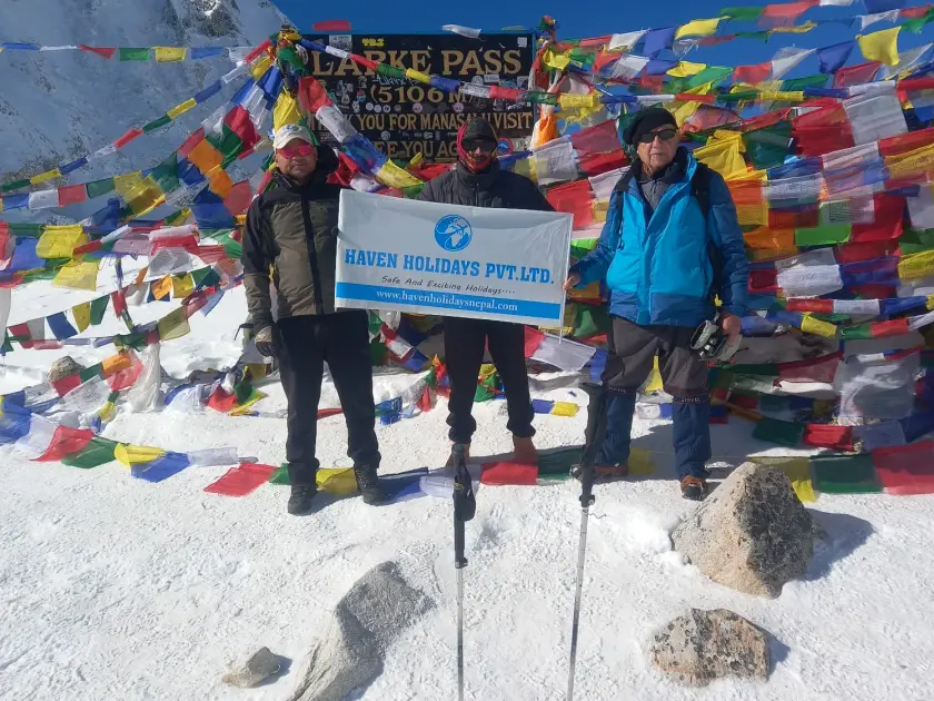
Note: This article originally appeared on the Haven Holidays Nepal Blog and has been republished here with permission..
About Haven Holidays Nepal: Haven Holidays is a locally based trekking company in Kathmandu, offering tailor-made adventures to Nepal’s most iconic destinations including Annapurna Base Camp, Everest Region, Manaslu Circuit, and Langtang Valley. Visit us at www.havenholidaysnepal.com
| Concerned URL | https://www.havenholidaysnepal.com/blogs/trekking-from-machhakhola-to-jagat |
|---|---|
| Address | |
| Source | https://www.havenholidaysnepal.com/blogs/trekking-from-machhakhola-to-jagat |
| Keywords | Manaslu Trek |
| Target group(s) | Destinations , Businesses , Travellers , Education, Research, Consultancy |
| Topics | Natural Heritage & Biodiversity , Travel, Transport & Mobility |